What is a VFR Flight? Why you should Know!
(Flight Simulation Only!)
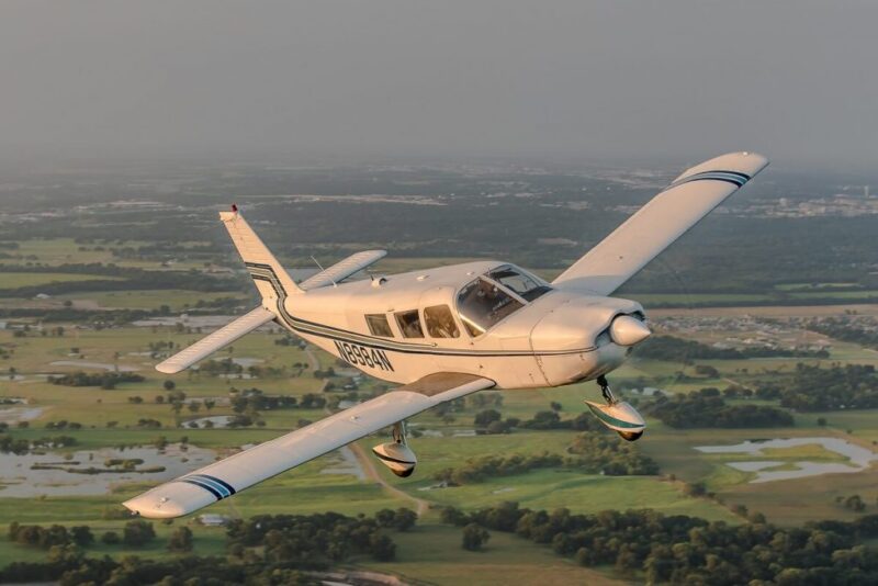
What is VFR flight and why is it used by ultralight pilots to military pilots. One of the main reasons VFR flight is so popular is that it is more flexible and providing weather is not a limitation easier manage.
Taking off into clear skies or even with some cloud VFR offers the freedom to fly without having to be directed by ATC. Yes you can always request assistance with flight following from ATC. Flying VFR you are not locked to a strict heading and needing permission to change direction or altitude.
What is VFR?
VFR is an abbreviation for Visual Flight Rules and these rules govern how and where pilots can fly. There are different rules for day and night VFR which depend on what airspace you intend to fly in. We will look around night VFR later. What is VFR is flying? It is flying in day light hours primarily with visibility of 5 miles and clear up to an altitude of 3000ft above ground level or AGL.
VFR Altitudes and Direction.
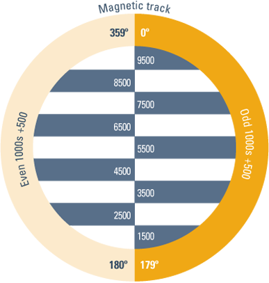
There are guidelines for what altitude a pilot can fly depending on your heading. This is to assist with controlling aircraft separation. It ensure aircraft on opposing courses generally have 1000ft separation vertically. These rules are governed by what direction/heading an aircraft is flying. If an aircraft is flying on a heading of 0 to 179 degreed they must fly ODD numbered altitudes.
These altitudes start at 1500ft, 3500ft, 5500ft and 7500ft altitudes up to the transition altitude. Flying from 180 degrees to 359 degrees a pilot must fly even altitudes plus 500 ft. That is 2500, 4500, 6500ft etc. again up to the transition level. An easy way to remember could be a saying such as EAST is Least and West is Best being flying westward you start at a higher altitude.
Transition Altitudes above VFR Flight.
What is a transition altitude? The transition level is differentiated by what QNH or pressure setting, is used in the altimeter. The transition level changes at different altitudes around the world. This ensures there is not one answer to this question. In Australia the transition altitude is 10,000ft where the USA is much higher at 18000ft. In Europe it can be as low as 3000ft in both the UK and Europe. There are many variations so check what’s required in your country.
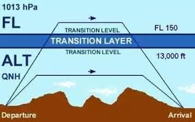
Transition altitude is the altitude in which the pilot must change from QNH or local area air pressure to the standard transition level QNH of 1013.2 hector pascals. This setting is dialled into your altimeter or flight display manually by the pilot.
QNH Where do I get it?
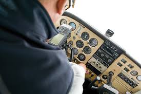
Under the transition level you can get local QNH or local air pressure setting. These can be found from airport reports that are updated hourly. Simply tune into the ATIS (Automatic Terminal Information Service) frequency at the closest airport. Note the current QNH and adjust your altimeter to ensure the correct altitude is reading on the altimeter.
An incorrect pressure setting can have you at a vastly different altitude from what you see on your altimeter. It is especially dangerous if there are high towers, buildings or hills on your route. Planning to transition past with only a couple hundred feet altitude clearance of these objects can be fatal. There is a 25ft difference for every single Hectopascal makes approx. 25ft in altitude difference so every 4 HP will be 100 ft approx. difference in altitude.
- Joystick / HOTAS – AMAZON.com
- Rudder Pedals – AMAZON.com
- Throttle Quadrant – AMAZON.com
- Gaming Chair – AMAZON.com
- VR Headset – AMAZON.com
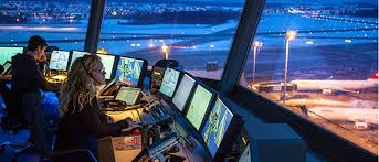
Flying VFR and ATC.
When flying VFR it’s not always a requirement to speak to air traffic controllers or (ATC). If you file a VFR flight plan ATC does not see it. You are on your own to navigate and avoid all other air traffic. A pilot flying VFR can request assistance from ATC in the form of flight following. The pilot is still primarily responsible for navigation and aircraft avoidance, but ATC can watch your transponder signal and keep you away from other aircraft as well.
CTAF Frequency. Keep in contact.
If flying in uncontrolled airspace and well as from an uncontrolled airport you use an area frequency or a CTAF (Common Traffic Advisory Frequency). In Australia it is 126.7 on your radio. In Europe the terminology is different with it being called “(Aerodrome) flight information service and is abbreviated as AFIS. You will find frequencies on navigation charts or on airport information plates.
What is VFR Flight and Cloud Limitations.
Flying VFR does not stop anyone from leaving the ground if there are clouds on the planned your route. Flying at an altitude that keeps you under or well clear of clouds is certainly required. If there are clouds on your chosen or assigned altitude you can fly around the odd clouds that present themselves in your flight path. Note you must have 5 miles and 3000ft clearance from ground to any cloud bases.
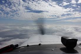
VFR on Top – Is it a Good Idea?
Planning a long flight and getting high to save fuel and increase ground speed is a great idea. What if there is a broken cloud layer between the ground and the planned cruising altitude. You may think you cannot fly above the clouds VFR but it is actually permitted. This is known as VFR on top. Its very important you are confident you can descend to your destination without entering cloud.
Flying VFR on top also increases the danger of icing on the aircraft. Icing is prominent when flying at low outside air temperatures (OAT) when there is humidity present. Flying above clouds is likely to be reasonably safe but transitioning through areas with cloud and descending through gaps in cloud. This brings the possibility of moisture in the air and low temperatures leading the to real possibility of icing forming on an aircraft. Caution should be advised. Monitor your AOT gauges and be aware f humidity as well as clouds on your route.
Safety is the Pilots Responsibility.
It is the pilots responsibility to plan to be able to descend from the cruising altitude to the destination airport without entering cloud. Depending on weather reports the pilot had better have a plan B,C and D incase things don’t work out as planned.
There are examples on YouTube where pilots got stuck on top of cloud with nowhere to descend and very few options. Fortunately this one ended up with some additional grey hairs but a gap was found and he survived.
It’s also very likely that some pilots never find a hole in the clouds and are forced to descend through cloud. If the pilot is not IFR (Instrument Flight Rules) qualified many do not survive the descent through clouds.
Spatial Disorientation Kills.
Spatial disorientation is a primary killer of VFR pilots when they fly inadvertently or deliberately into IFR conditions. Many are reported to have died lost control of their aircraft due to spatial disorientation. It’s something you don’t want to experience when flying but it happens even to highly qualified pilots.
The inner ear which keeps your balance along with no visual cues in cloud make pilots feel like they are turning when they are not. It will make pilots think they are climbing as well. It’s just a very confusing place to be and add additional stress and pressure to the situation and its often deadly.
Statistics over 60 years show a VFR pilot flying into IFR/Clouds will not survive longer than 178 seconds. If not back in VFR conditions in this very short time they will lose control of the aircraft and crash!
Night VFR – Instrument Rating Required.
So it’s a nice clear night and you want to fly VFR you need to understand the requirements. Firstly you must be instrument rated with an instrument rated aircraft. This is all covered by FAR 91.157.
Visual requirements are 1nm visibility and able to remain clear of clouds. With all of the above you can contact ATC to be given a Night VFR clearance. You cannot just jump in your aircraft and fly.
Can I fly in Rain While VFR.
If you are already airborne and can remain 1000 ft agl (Above Ground Level) but flying below 3000ft and can remain clear of cloud. Its also required that you maintaining 5nm visibility it is permissible.
I would expect this would have to be light to moderate rain as we all know what it is like driving a car in rain. Although permissible the other consideration is rain could lead to ice. Ice can damage propellers in some cases as well as damage paint and damage the leading edge of the wing primarily.
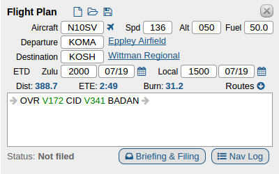
What is a VFR Flight Plan?
A VFR flight plan is used by a pilot intending a flight which must be submitted and approved by your local authorities like the FAA. The flight plan must be submitted and approved before the flight can commence.
The flight plan is required by commercial, private jet pilot or even a dispatcher. The flight plan shows the planned route the aircraft plans to take to its destination.
What is a VFR Corridor?
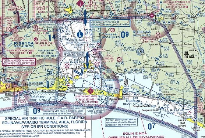
A VFR corridor is a defined vertical and horizontal space through a Class B controlled airspace region. As a VFR pilot you can plan to use the corridor without restrictions. The corridor is open to VFR pilots to use and they are not required to contact ATC for permission to enter. It goes without saying Class B airspace is going to be busy so using a corridor requires accurate flying to ensure the aircraft remains within the boundary of the corridore.
VFR Transition Routes.
VFR transition routes are.different from VFR corridors in that to use them you must have ATC Permission. These routes are like freeways in the sky with many aircraft using these popular routes between destinations.
ATC ensures the high number of aircraft using these VFR Routes remain separated in both altitude and distance as to remain safe but efficient.


- Latest CPU’s Available Now – Amazon.com
- Get a NEW GPU Best Performance – AMAZON.com
- Upgrade RAM Here today – AMAZON.com
- Prebuilt PC Options – AMAZON.com
Author
Brendon McAliece (Aka Gunnie) is a military veteran with 23 years working on Jet Fighters, their weapons systems and ejection seat/module systems as well as munitions and R&D. Involved with flight simulation since the 1980s, he has flown all the major flight simulators over the years.
He is an Australian expat who has lived in Malaysia, UK, Saudi Arabia and more recently Thailand. He is a multi-lingual blogger who loves to share his life experiences here on LetsFlyVFR.com and DreamingGuitar.com, with his lifestyle and Travel experiences Blog plus his Dreaming Coffee website.
Learn More @ DreamingGuitar.com – DreamingCoffee.com – LetsFlyVFR.com
( HOME – BLOG – SHOP – ABOUT )
As an Amazon affiliate I may benefit from qualifying sales.SearchSearch